
|
click any of the images to see a larger image
|
|
|
SUN VALLEY |
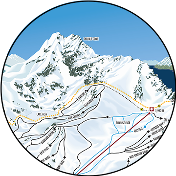
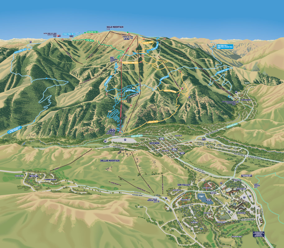
New trail 2018-19 trail map of Bald Mountain, Sun Valley, Idaho
|
New client for the 2018-19 season, recently completed Winter trail maps for Sun Valley, Idaho. Maps include main map of Bald Mountain and separate map of Dollar Mountain.

Dollar Mountain trail map for 2018-29
|
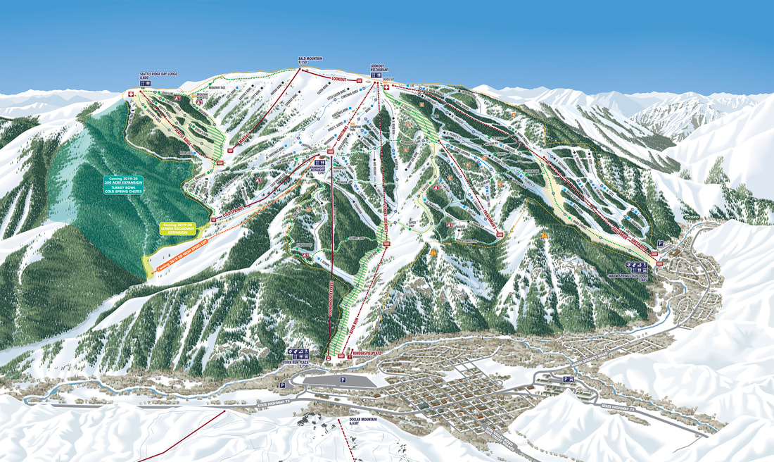
Main mountain rendering of Bald Mountain, Sun Valley
|
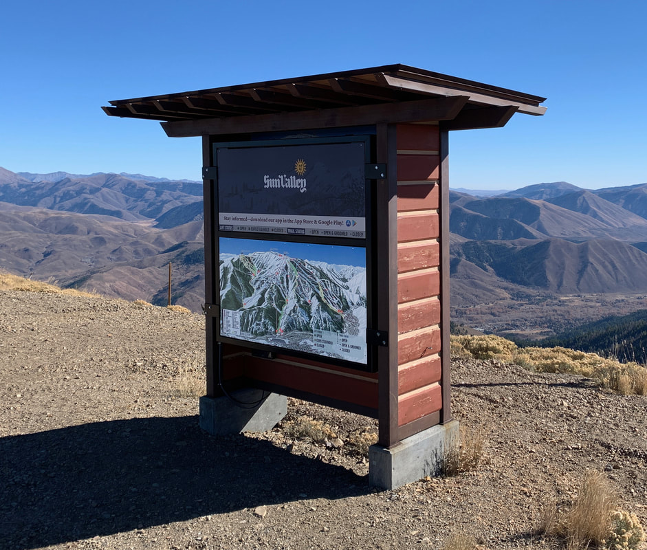
On mountain map and skier information display at Sun Valley
|
|
|
SUN VALLEY SUMMER MAPS |
New Summer map conversion of Sun Valley for Hiking/Biking and other activities.
|
New for Spring 2019!
Summer Hiking/Biking map for Sun Valley. Building on the new Winter trail maps, VistaMap expanded the view to include Bald Mountain, Dollar Mountain and Sun Valley Village and converted to Summer colors and information. The expansion also included a Sun Valley Village map that includes information specific to the village and an inset map including the Hiking/Biking trails in the White Clouds area. The Hiking/Biking terrain on Bald Mountain extends around the backside of the mountain so VistaMap created an inset map for those trails. |
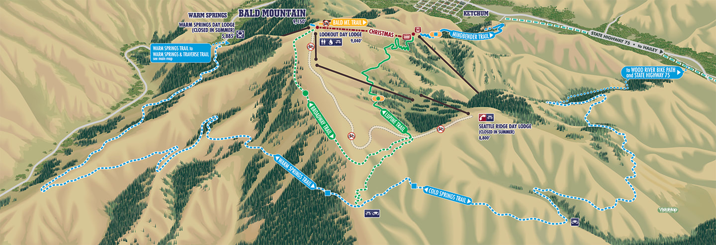
Inset map to illustrate the Hiking/Biking trails that continue around the back side of Bald Mountain.
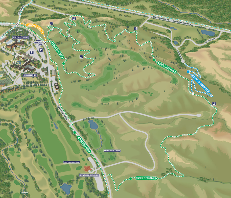
Inset map for the White Cloud area.
|
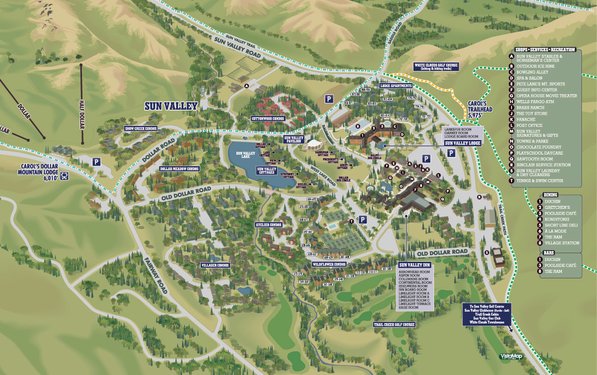
Detailed map of Sun Valley Village.
|
LOON MOUNTAIN RESORT
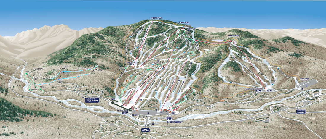
New 2020 Summer trail map for Loon Mountain, Lincoln, New Hampshire.
A new client for 2020, the Loon Mountain Resort project includes both Winter and Summer versions and includes a significant amount of terrain outside the core ski area to allow for additional cross-country skiing and mountain biking trails.
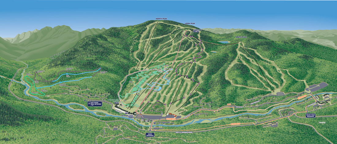
New 2020 Summer trail map for Loon Mountain, Lincoln, New Hampshire.
|
|
SUNRISE PARK RESORT |
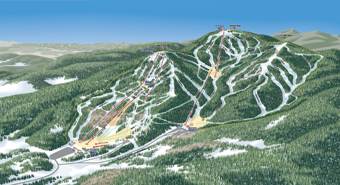 New Winter trail map of Sunrise Park Resort in Greer, Arizona. New Winter trail map of Sunrise Park Resort in Greer, Arizona.
|
New client for 2020, Sunrise Park Resort joins the VistaMap portfolio with a new trail map that updates the resort information and takes a fresh and more accurate view of the terrain.
|
GRANITE PEAK
|
New client for 2020, Granite Peak gets a much needed new trail map. The primary map is shown here, but the master file contains significant additional terrain on both ends of the resort for future expansion.
|
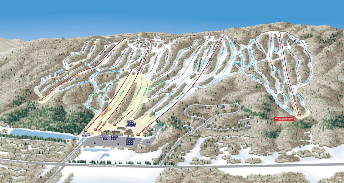
New Winter trail map of Granite Peak, Wausau, Wisconsin.
|
|
|
MT BALDY |
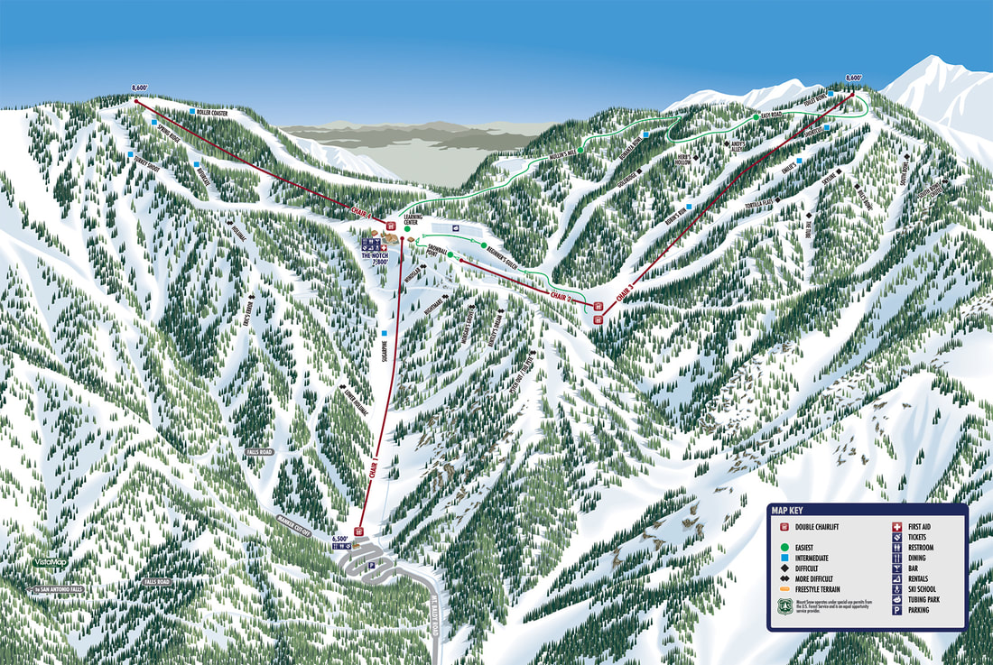
MT BALDY, CA
|
New client for the 2017-18 ski season, Mt. Baldy has a few unique features that made it a challenging map to produce.
|
LIME ROCK PARK |
|
I have been going to Lime Rock Park since the late 60's.
In 1999 I produced a track map for the park that has been used by Lime Rock since then. 20 years later while doing some routine updating, I decided to make some corrections to the track layout and facilities in general to create a fresh look. |
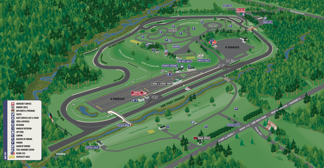
Updated for the 2019 is the new Lime Rock Park track map.
|
Frontside Map
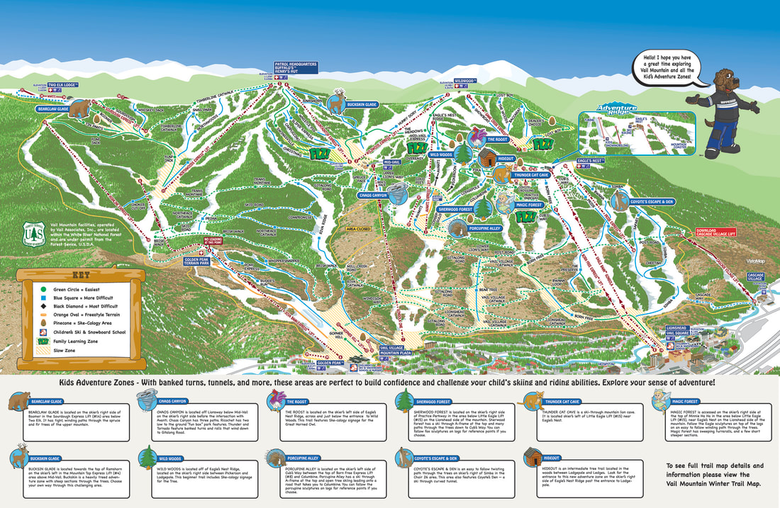
Vail Mountain, CO Adventure Zone - Family Learning Zone map.
Adventure Zone custom icons.
|
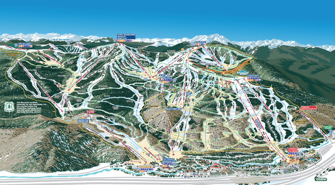
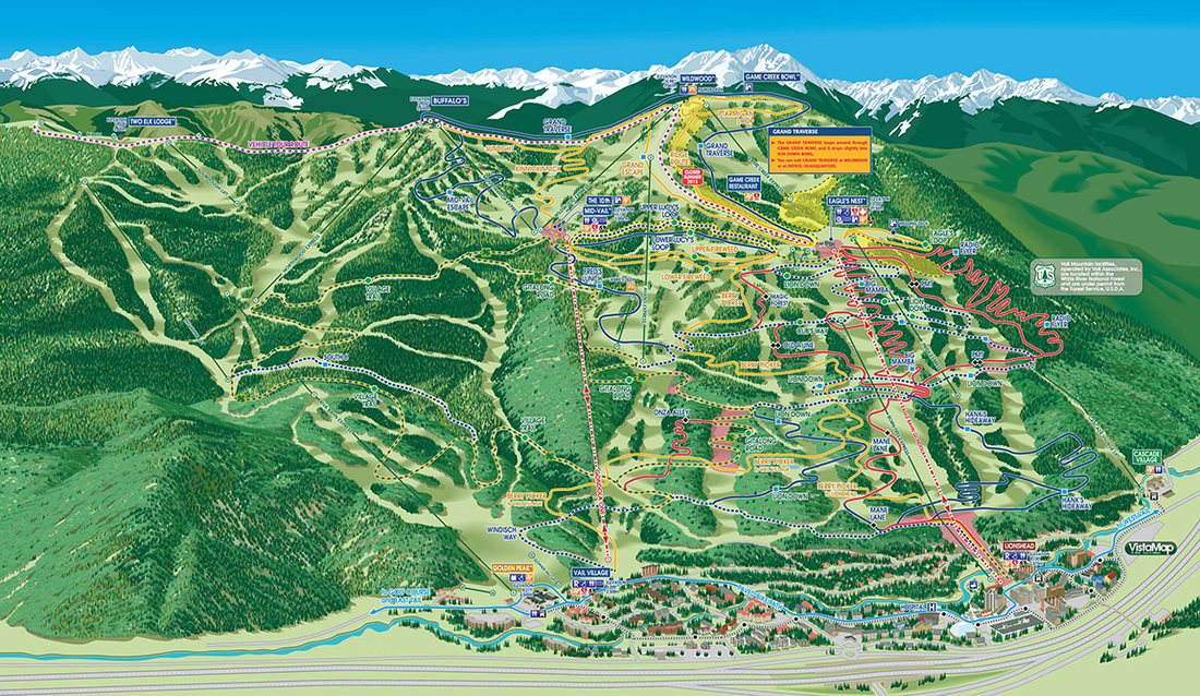
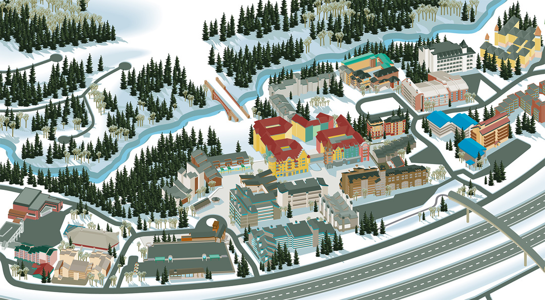
VAIL COLORADOClient since 1999
Five maps including main Frontside Map, Back Bowls and Blue Sky Basin. Winter and Summer versions, plus a detailed Town of Vail map.
Vail Mountain in 1999 the largest ski resort in the U.S. with 5,300 acres. The sheer size and layout required three maps to cover the skiable terrain. VistaMap’s first large, multiple map project. For over 16 years, VistaMap has continued to service the maps adding new features and updated information annually.
NEW for 2018-19 SEASON! Vail Mountain has a variety of Adventure Zones and Family Learning Zones that provide unique and fun features to build confidence and challenge kid's skiing and riding abilities through exploration. VistaMap simplified the map, updated colors, textures and fonts and created custom icons to key guests to the locations and descriptions of the Adventure Zones and Family Learning Zones. |

|
|
VAIL GAME CREEK BOWL |
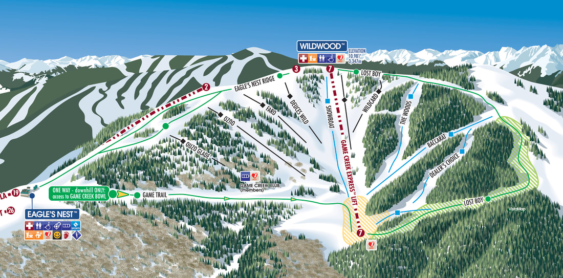
New Game Creek Bowl inset map.
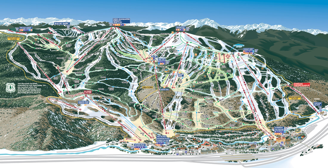
Updated Vail Mountain trail map including the new Eagle's Nest Ridge modification for 2019-20
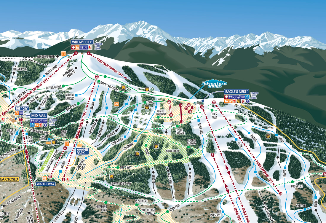
New Eagle's Nest Ridge modification for 2019-20
|
In 1999, VistaMap created a new set of trails maps for Vail Mountain and has maintained and updated those maps and added to that suite of maps ever since.
For the 2019-20 season, Vail requested a major change which involved creating a dedicated inset map for Game Creek Bowl and drastically reducing the depiction of that bowl on the Frontside map by adjusting Eagle's Nest Ridge. This resulted in several positive benefits: - Over the many years since the first version, Vail has continually added more information and services...the expanded Eagle's Nest area provided significantly more room for labels, icons, etc and is now visually less busy. - The adjusted ridge is now depicted more accurately and more to scale. Although the changes affected about 20% of the Frontside map, the VistaMap system allowed those changes to be completed seamlessly, without requiring a complete new trail map. 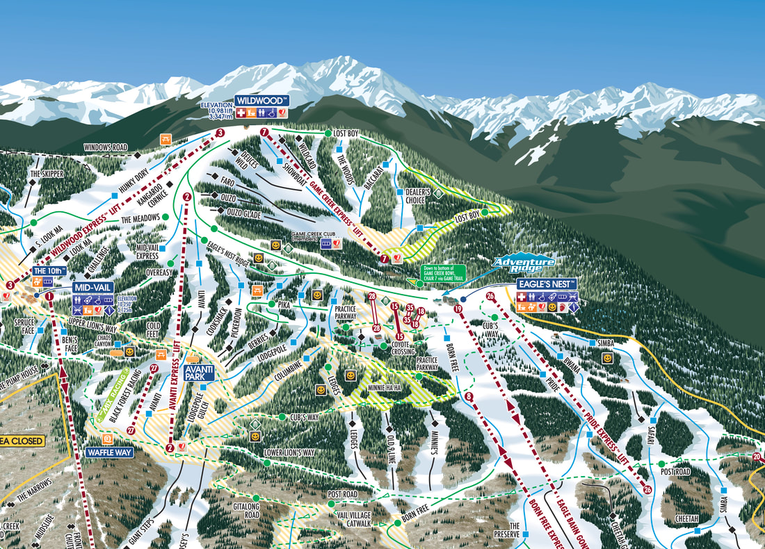
Original Vail Mountain trail map with the old Eagle's Nest Ridge area and Game Creek Bowl.
|
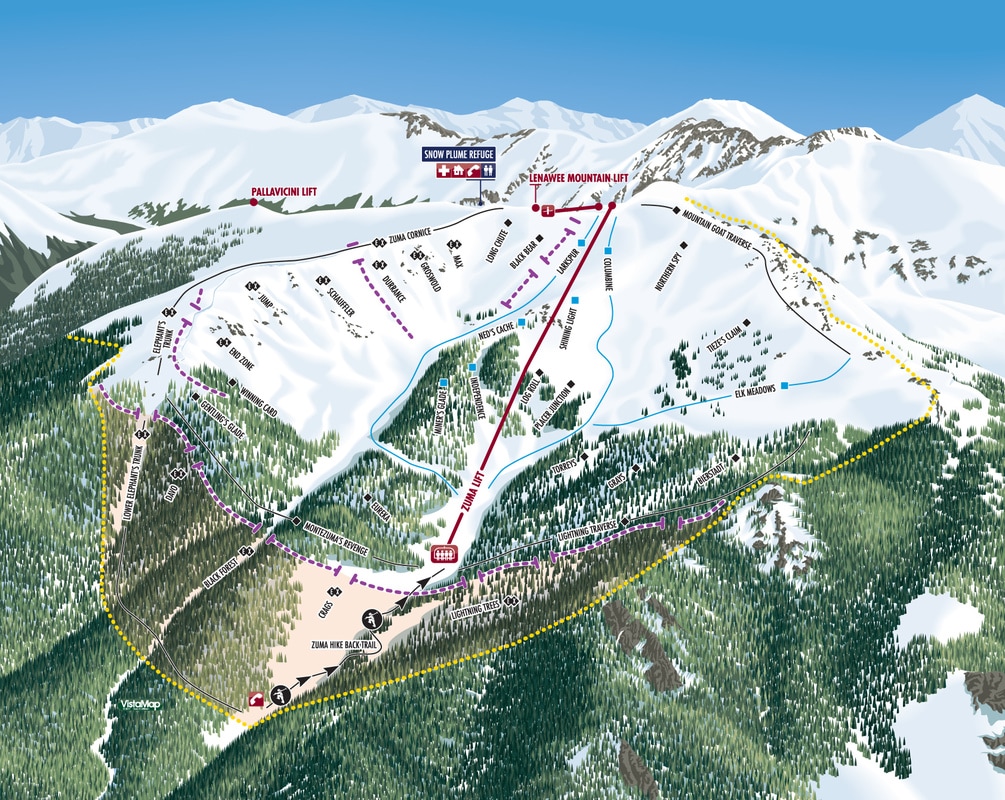
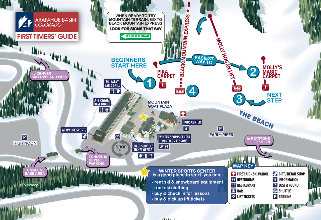
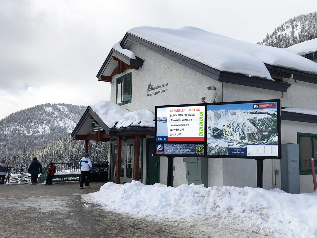
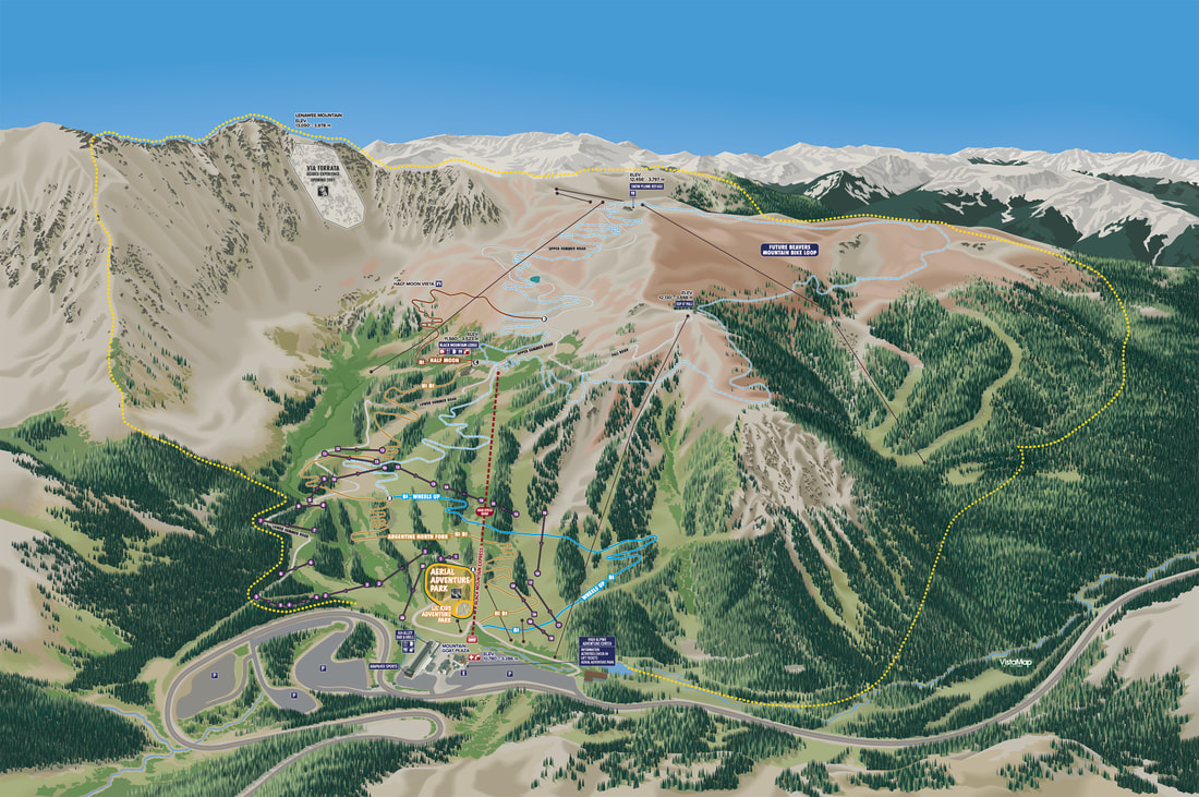
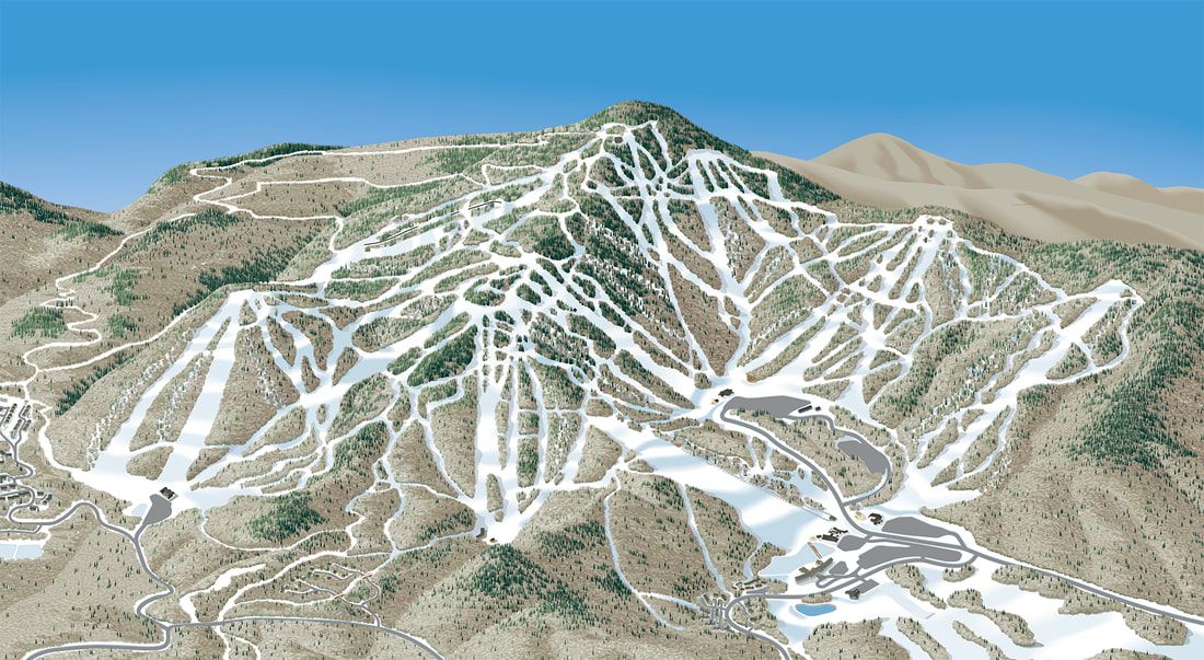
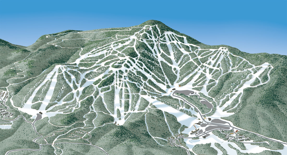
ARAPAHOE BASIN
|
New client in 2017-18
In early 2017, Arapahoe Basin announced the expansion of THE BEAVERS and THE STEEP GULLIES, adding hundreds of acres of new, lift serviced terrain. VistaMap is producing a new set of maps for the entire resort, a section of which is being used to promote the new expansion. Subsequent to the original Winter maps, VistaMap created a Summer conversion for A-Basin's expanding Summer operations and also a special use map, First Timer's Guide, created to direct first time guests through the process of arrival, rentals, lessons and accessing beginner lifts and terrain. |
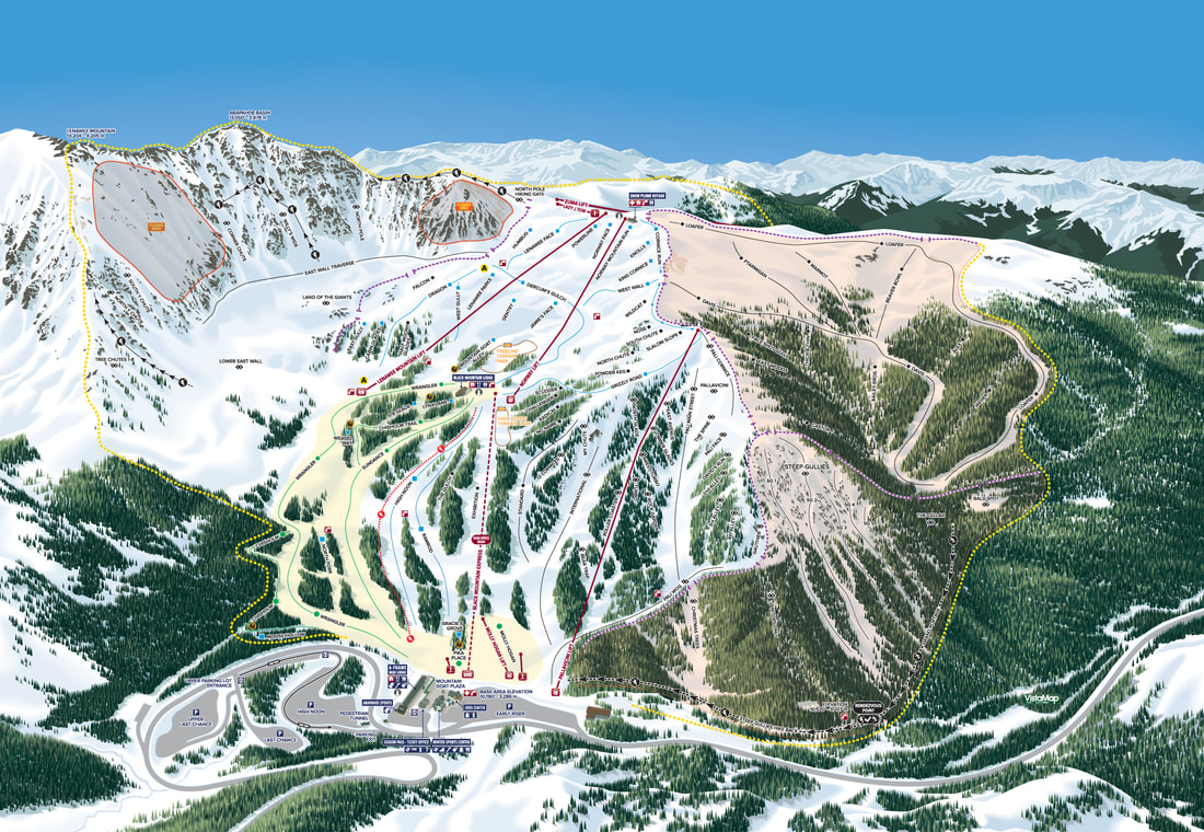
New trail map for ARAPAHOE BASIN
|
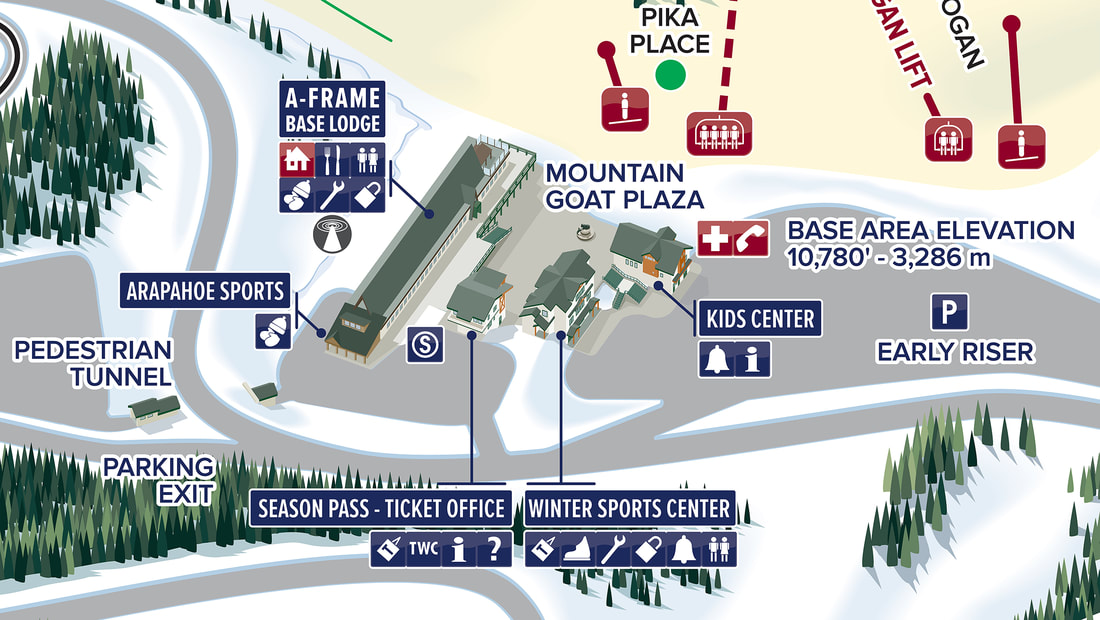
ARAPAHOE BASIN base area detail
|
ARAPAHOE BASIN - MONTEZUMA BOWL
|
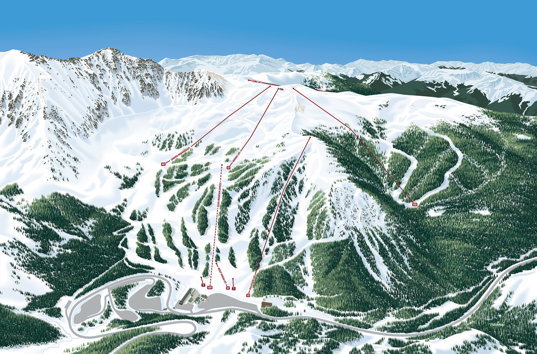
ARAPAHOE BASIN mountain rendering lifts only
|
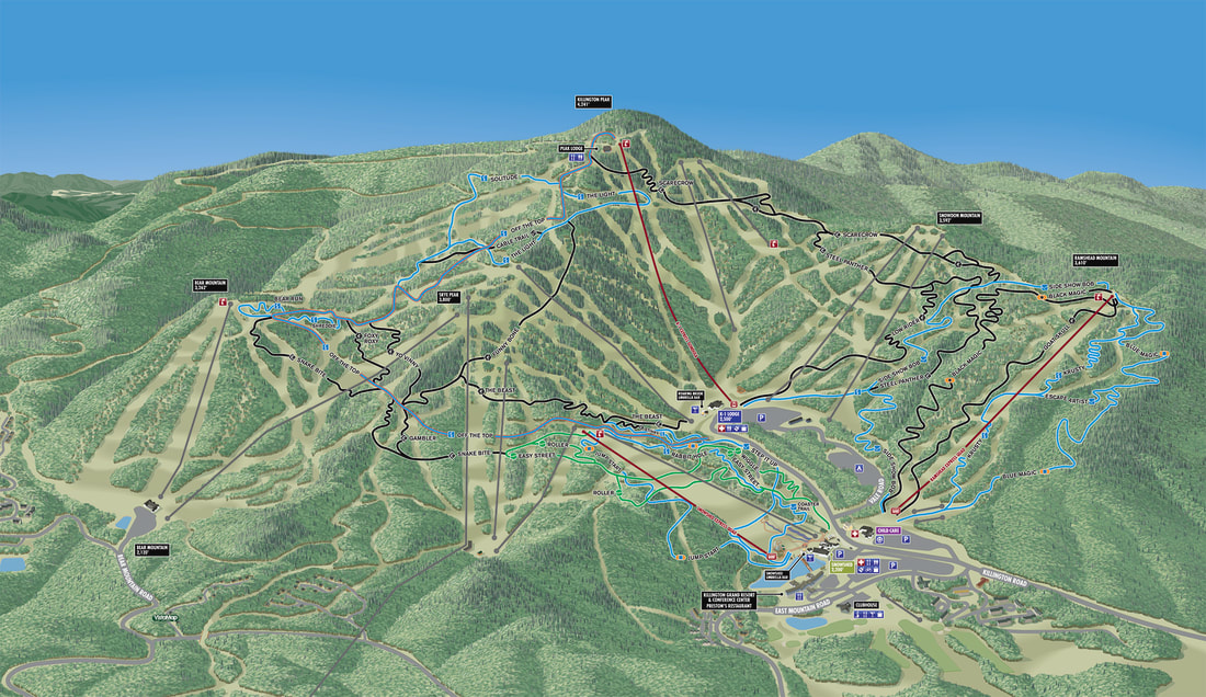
KILLINGTON
|
A new client for the 2017-18 ski season, new Winter and Summer trail maps for Killington, VT.
KILLINGTON with traditional Winter color treatment.
KILLINGTON requested an optional color palette.
|
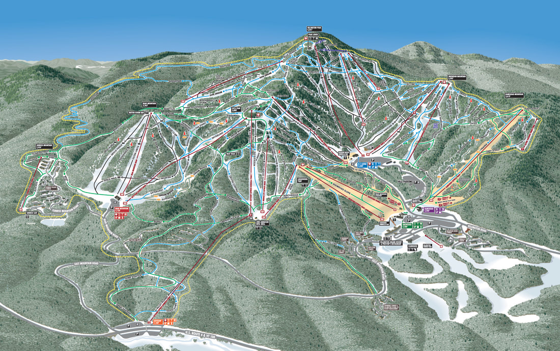
New KILLINGTON trail map including resort information layers
KILLINGTON Summer conversion for Biking.
|
|
|
MISSION RIDGE |
New trail map for Mission Ridge in Wenatchee, Washington.
|
Recently completed, VistaMap presents the new trail map for Mission Ridge. A challenging project because the variety of terrain, the shape of the resort including terrain on opposing faces and a substantial future expansion area in the lower left corner.
|
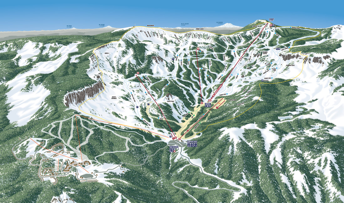
CRYSTAL MOUNTAIN |
|
|
A new client for the 2017-18 ski season, new Winter and Summer trail maps for Crystal Mountain, WA. 
NORTH PEAK inset
|

New CRYSTAL MOUNTAIN trail map
|
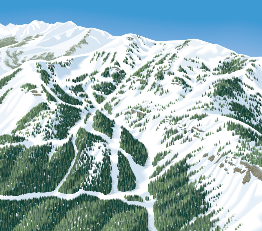
NORTH PEAK inset base rendering
|
New CRYSTAL MOUNTAIN trail map base mountain rendering
|

CRYSTAL MOUNTAIN Summer conversion for Hiking and Biking.
WILLARD
|
VistaMap loves small ski areas too! A new client for the 2017-18 ski season, Willard is a small area in upstate New York with a very loyal clientele. Proper scale and detail puts the shine on these smaller maps. |
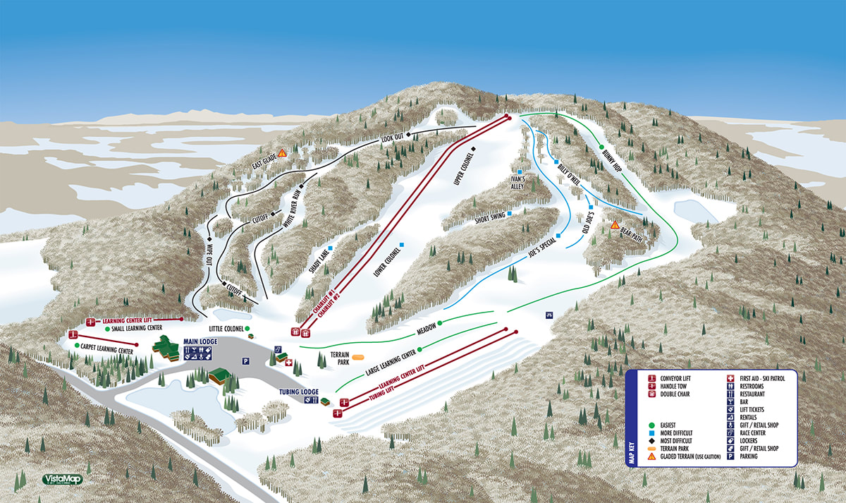
WILLARD
|
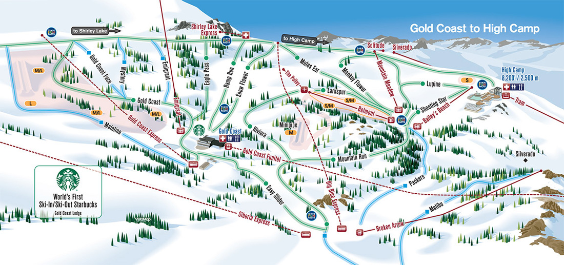
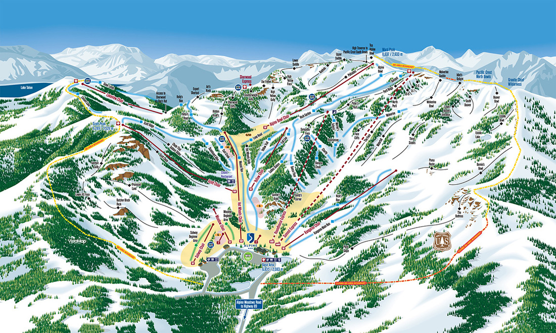
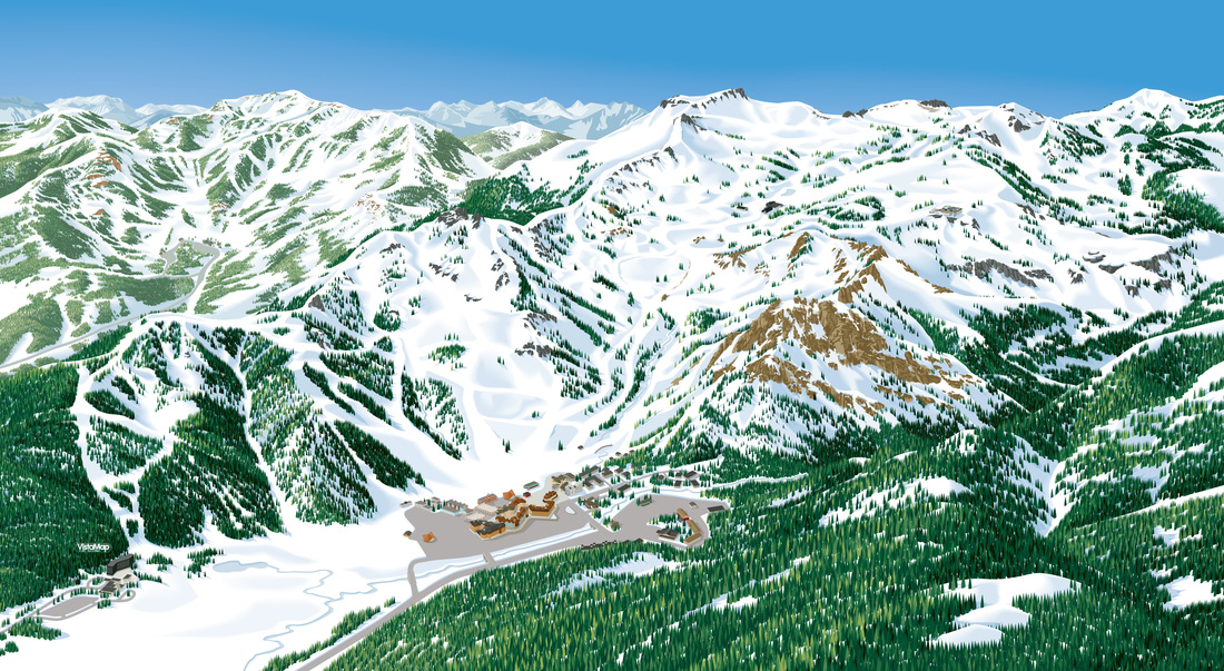
PALISADES TAHOE / ALPINE MEADOWS
|
Client since 2008
Beginning with maps for Alpine Meadows and Homewood in 2008 where VistaMap’s first projects in the Lake Tahoe region. In 2011 VistaMap created five maps for Palisades Tahoe. Ultimately, Palisades Tahoe purchased Alpine Meadows and the two resorts combined offer over 6,200 acres of terrain. There are two maps to cover Alpine Meadows and five maps for Palisades. The Palisades maps include a detailed, close up inset of the mid-mountain Gold Coast to High Camp area which is the primary location of the resorts beginner terrain. The extra inset map provides a more accurate and clear view of this terrain, a key in assisting beginner and novice skiers to identify, navigate and enjoy their day.
Summer activities at Palisades Tahoe utilize a Summer conversion map.
|
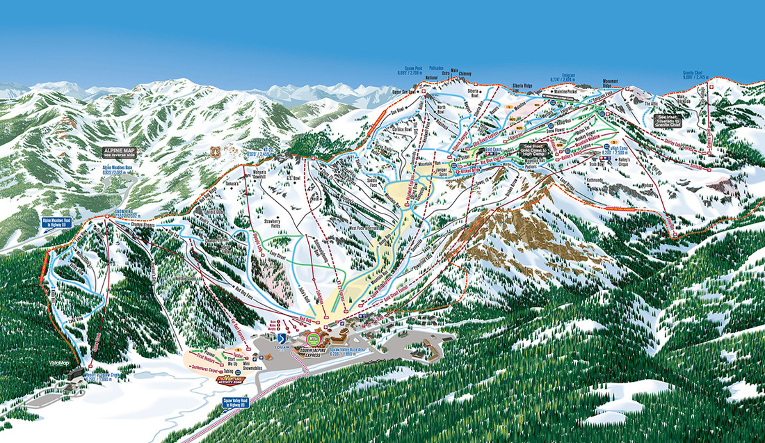
Frontside Map
|
|
|
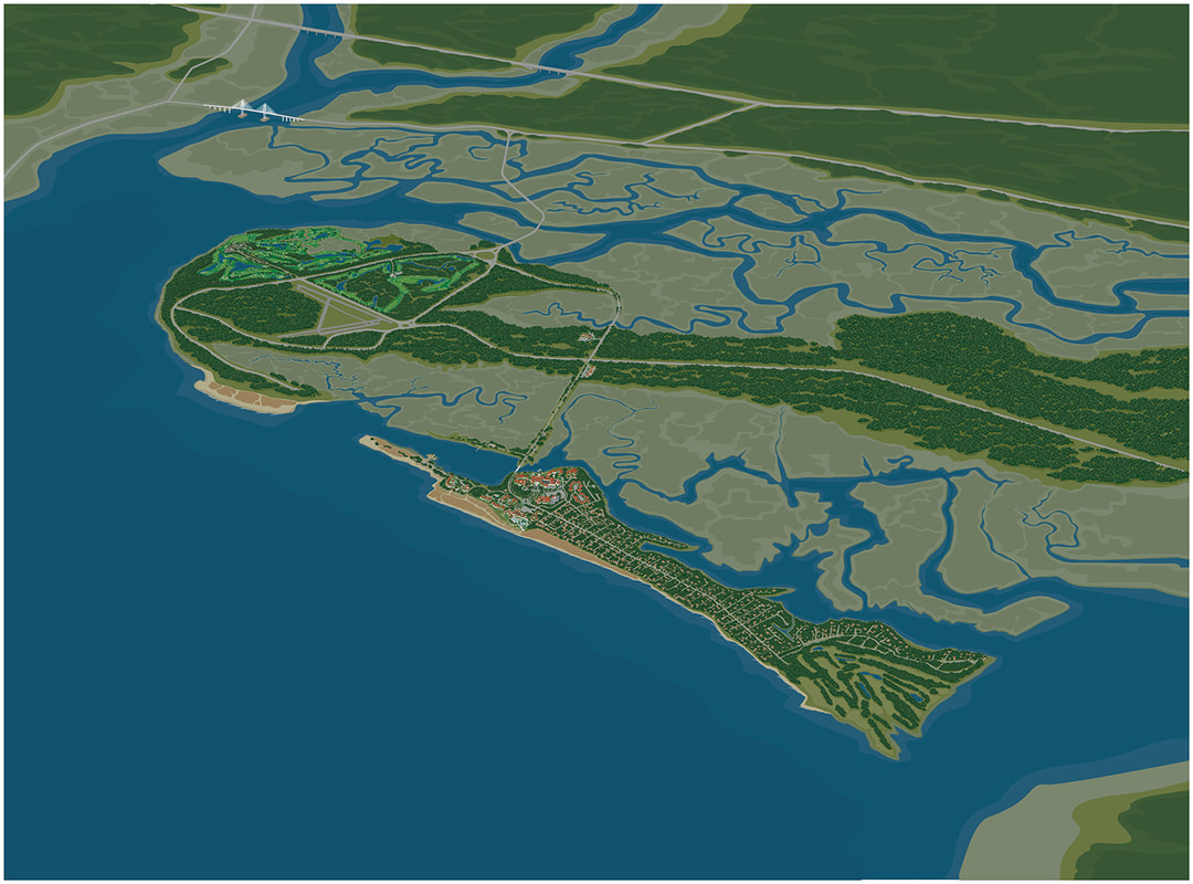
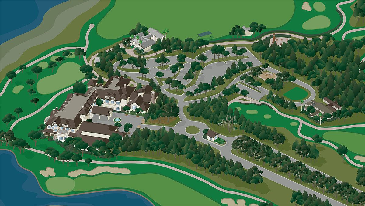
SEA ISLAND |
Sea Island complete map
|
-A new client for 2016, Sea Island Resort is an incredibly complex project. The overall view map includes about 100 square miles to show the relationship from Interstate 95 to the resort.
As the viewer zooms in, the artwork becomes more detailed to give an accurate visual reference to three essential clusters of facilities: -The Lodge, home of two PGA golf courses, The Seaside and Plantation Courses and the newly redesigned Retreat Course (by Davis Love III and his brother Mark). -The Cloister and Beach Club, with a wide variety of five star accommodations and recreational opportunities. - The Inn and The Market, a little more casual lodging and shopping for fine wine, gifts and gourmet foods. |

The Cloister
|
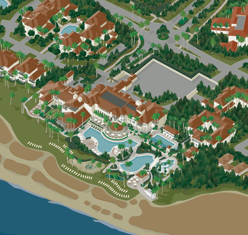
Beach Club
|
The Lodge
|
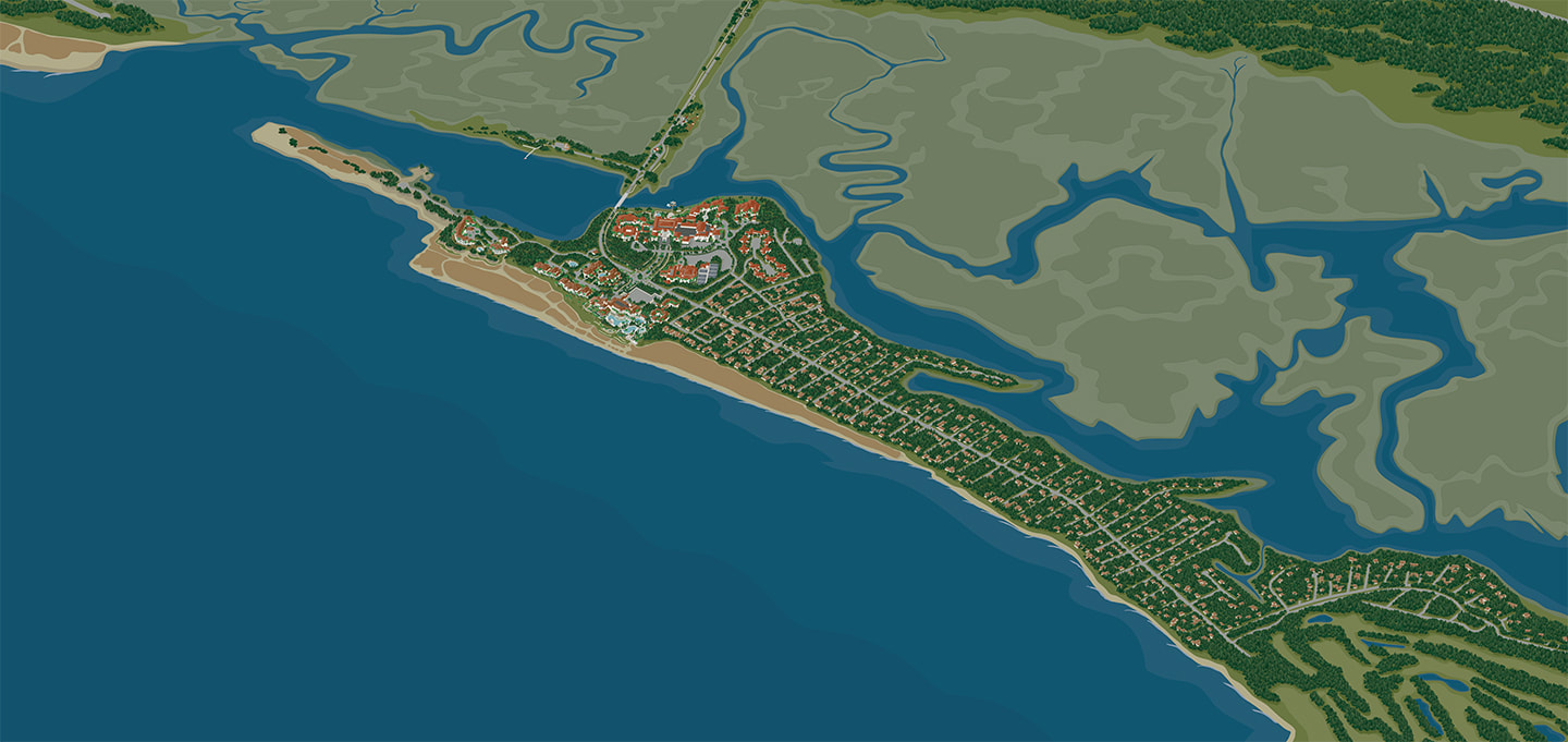
Sea Island
|
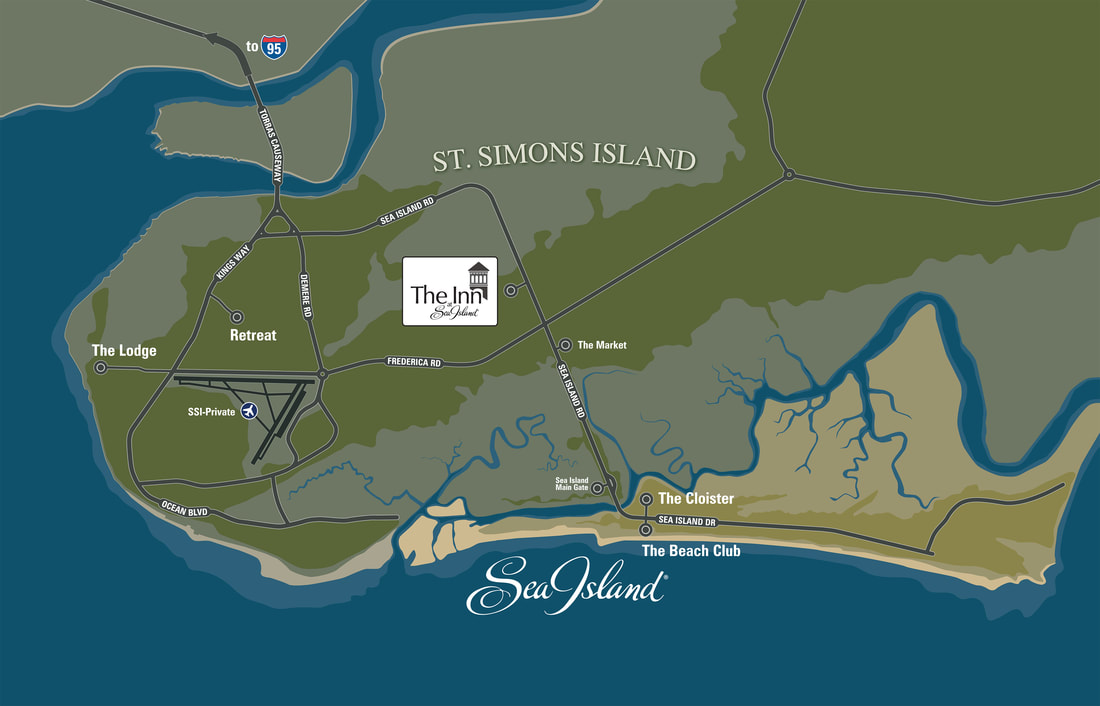
Locator map for The Inn at Sea Island
|
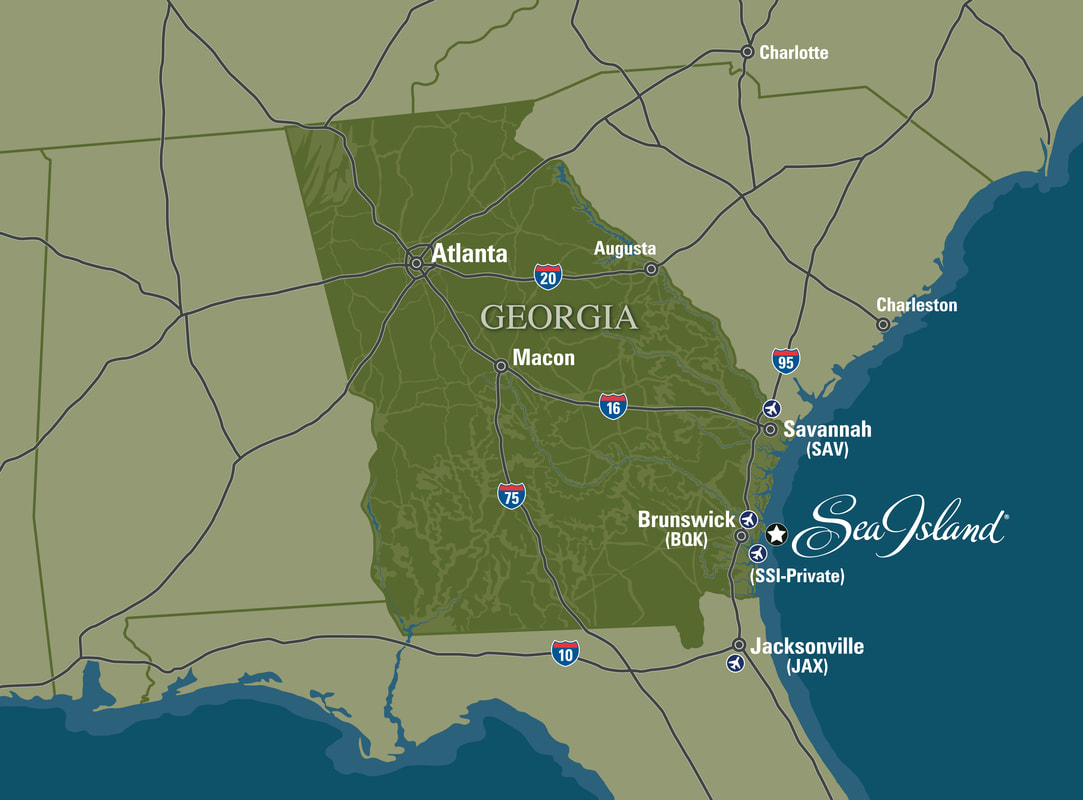
Sea Island Georgia location map
|
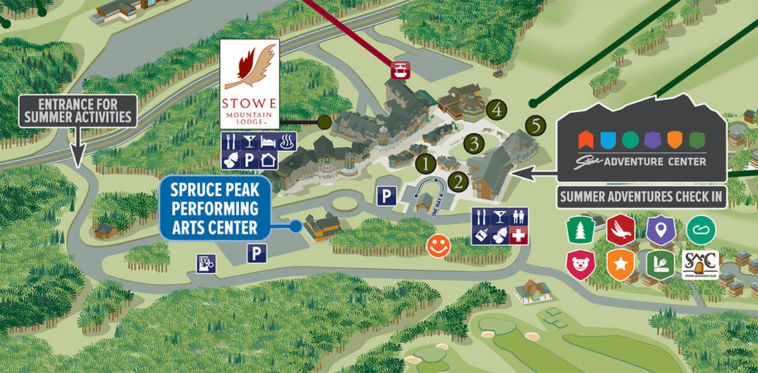
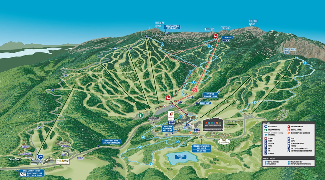
STOWE MOUNTAIN RESORT
|
VistaMap client since 2005, Stowe, VT has one Winter map and a Summer conversion map. Starting in 2005, VistaMap produced a new trail map for Stowe Mountain Resort. While the resort is spread over two peaks, Spruce Peak and the highest peak in Vermont, Mount Mansfield, the full terrain was captured in one main view. Since 2005, Stowe has continued to develop the Spruce Camp Base area, with the addition of a new lodge, hotel, on-mountain homes and most recently a new Adventure Center, updated annually to reflect this growth. During the Adventure Center construction, several additional specialized maps were created to guide guests to new parking areas and facilities. Stowe also uses a Summer conversion map. |
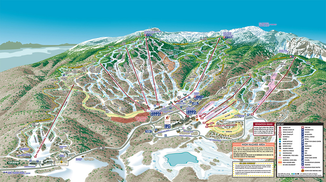
STOWE MOUNTAIN RESORT
|
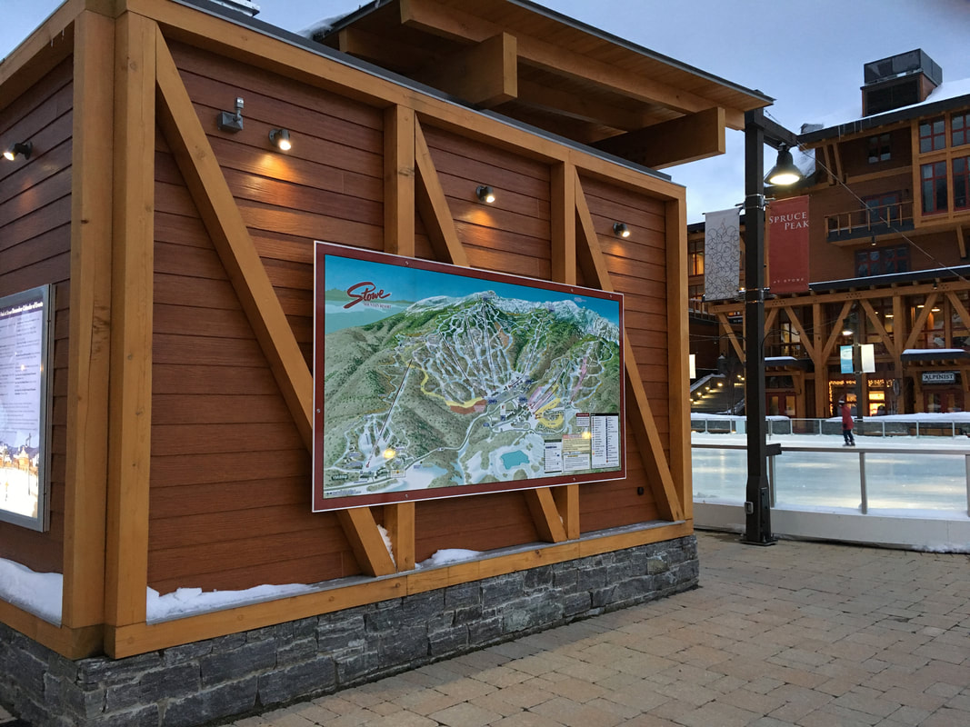
Outdoor map display at Stowe Mountain Resort
|
|
THE REMARKABLES |
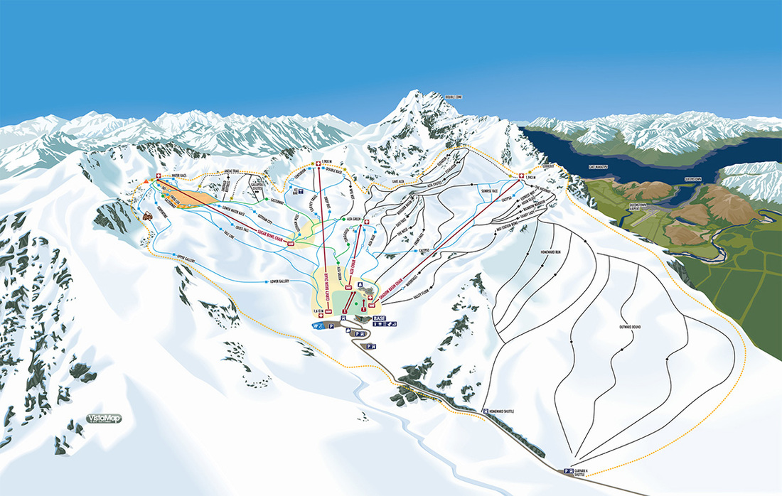
THE REMARKABLES
|
The Remarkables, NZ, VistaMap’s first project in New Zealand, 100% of the resort is above tree line. Client since 2014. In 2014, The Remarkables added a new lift, servicing terrain which was not adequately depicted on the exiting trail map and VistaMap was contracted to create a new map to not only include the new terrain but also more accurately show the existing terrain. The Remarkables is 100% above tree line and offers skiing across 180 degrees from the base area. Most notable in this map is the inclusion of all of the terrain in one main view and the level of detail in the terrain features and the many majestic rock features that line the summit. |
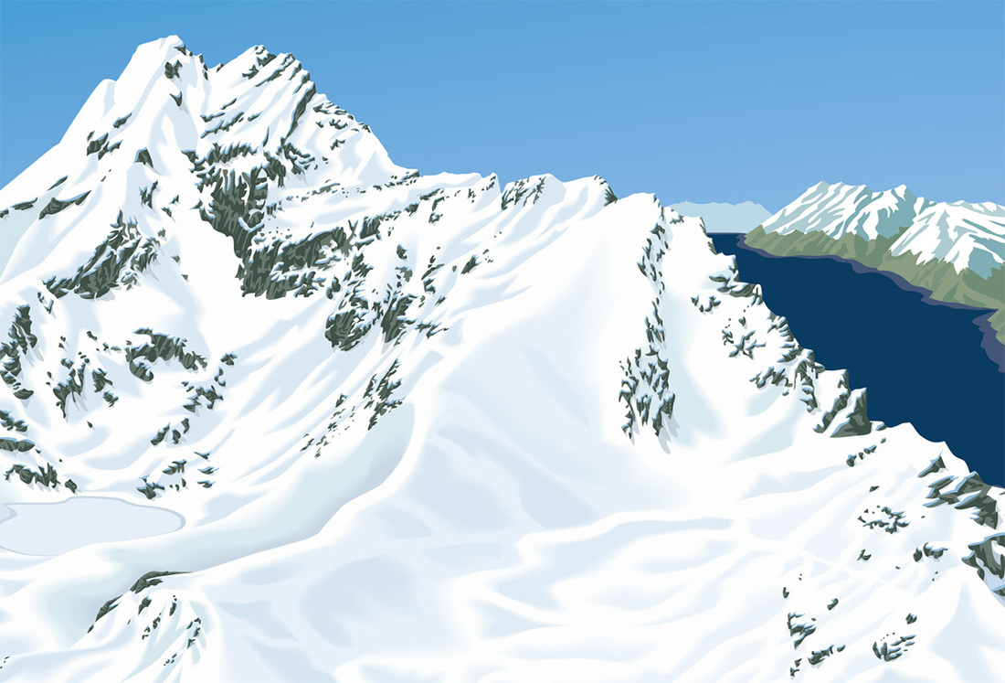
Rock Detail
|
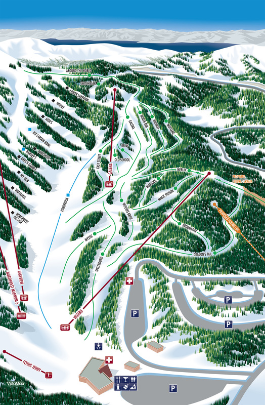
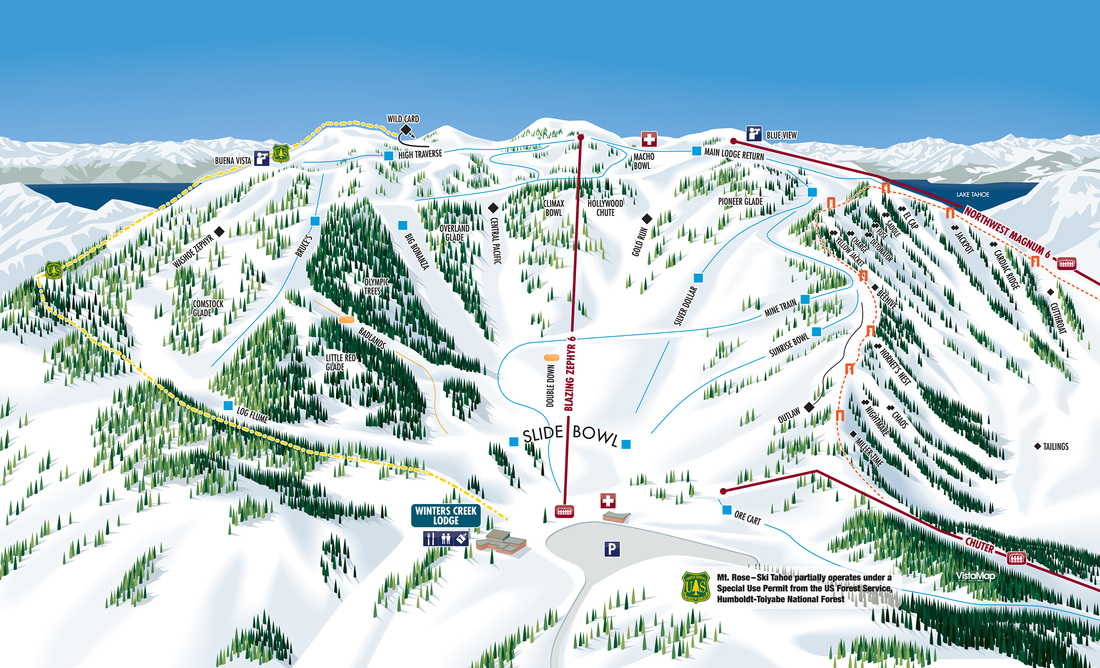
MT ROSE
|
Completed for the 2014-15 ski season, the Mt Rose project included three maps, the main frontside map, Slide Bowl and a beginner specific map.
|
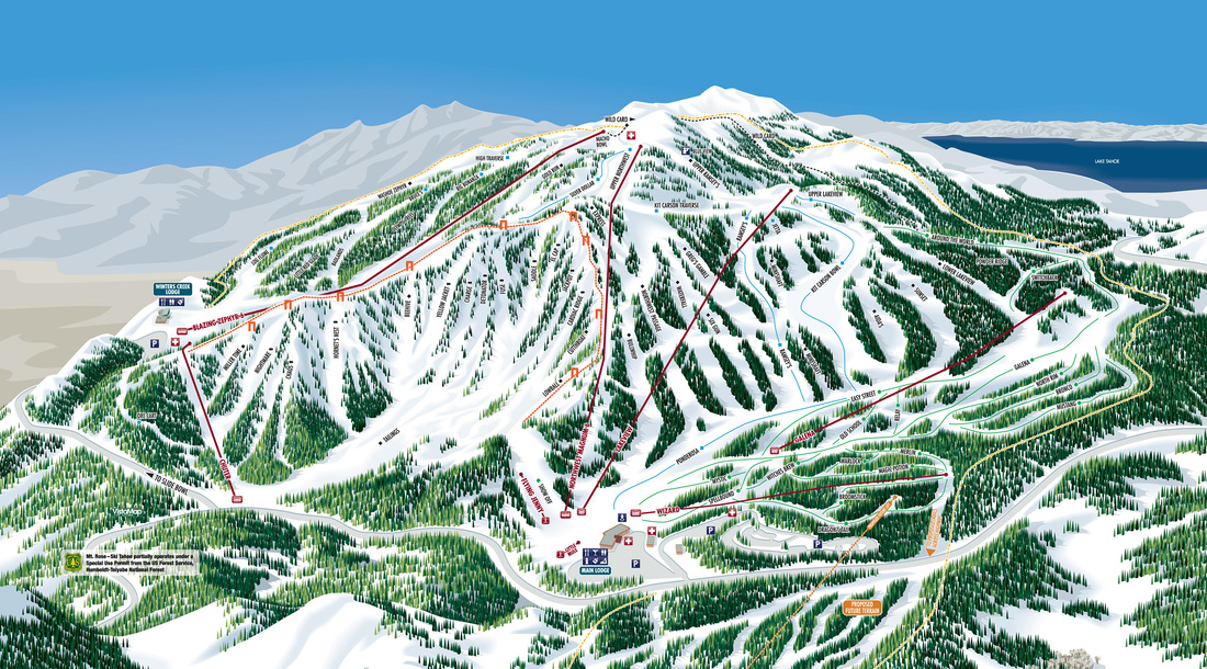
FRONTSIDE MAP
|
|
|
PINE MOUNTAIN RESORT |
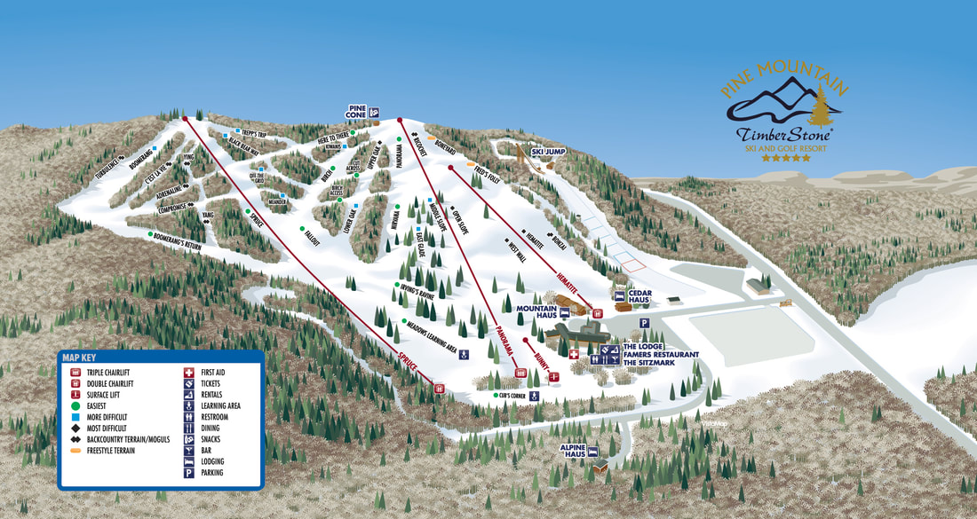
New Pine Mountain Resort, MI. trail map for 2019-20 season.
|
New for Winter 2019-20 season
Winter trail map for Pine Mountain Resort, MI Proving once again that VistaMap puts the same quality effort into the fit and finish of smaller resorts as our larger clients. |
WEST MOUNTAIN
|
New client for 2020, West Mountain gets a fresh look, with more accurate terrain and scale, also a new summit treatment that allows for Summer XC hiking and biking trails to be included. Summer conversion is in the works for 2021.
|
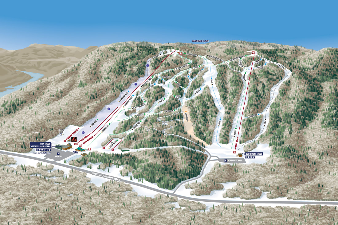
New Winter trail map for West Mountain in Glens Falls, New York.
|
|
|
HOLIDAY VALLEY |

HOLIDAY VALLEY
|
A new client for the 2015-16 ski season, Holiday Valley is a classic Eastern resort with a wide range of terrain on several opposing faces.
|
MONT DU LAC
|
Mont Du Lac packs a lot into a small area. Alpine skiing, tubing, ice skating in Winter, hiking, biking, disc golf, boating, tubing and a wide variety of overnight accommodations from lodging suites to RV/campsites to rustic cabins.

|

|
|
|
SNOW KING MOUNTAIN RESORT |

SNOW KING MOUNTAIN RESORT
|
New for the 2014-15 ski season, Snow King Mountain Resort in Jackson is the revival of Wyoming's first ski hill, opened in 1939. Numerous Summer activities required both Winter and Summer versions. 
Snow King Summer map
|
LAKE GEORGE RV PARK
|
Lake George RV Park has been a client since 2001 includes
120 acres of full service RV sites, guest amenities such as pools, playgrounds, walking/biking paths, etc. The map was created to be used in the park as a general navigation reference, with the additional treatment of the individual site numbers so they can be easily highlighted on a paper map for guests at check in to provide clear directions to their site. |

LAKE GEORGE RV PARK
|
HERSHEYPARK
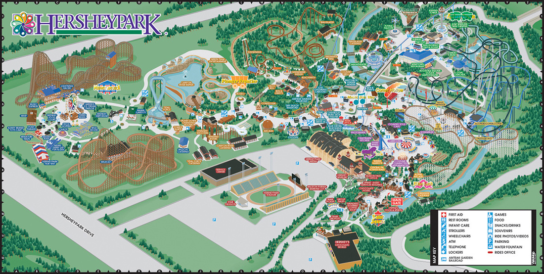
HERSHEYPARK
|
Created in 1999, the Hersheypark map covers over 120 acres and is a wild mix of terrain, rides, roller coasters, waterpark features and very difficult to cover all of the elements and maintain clarity. |
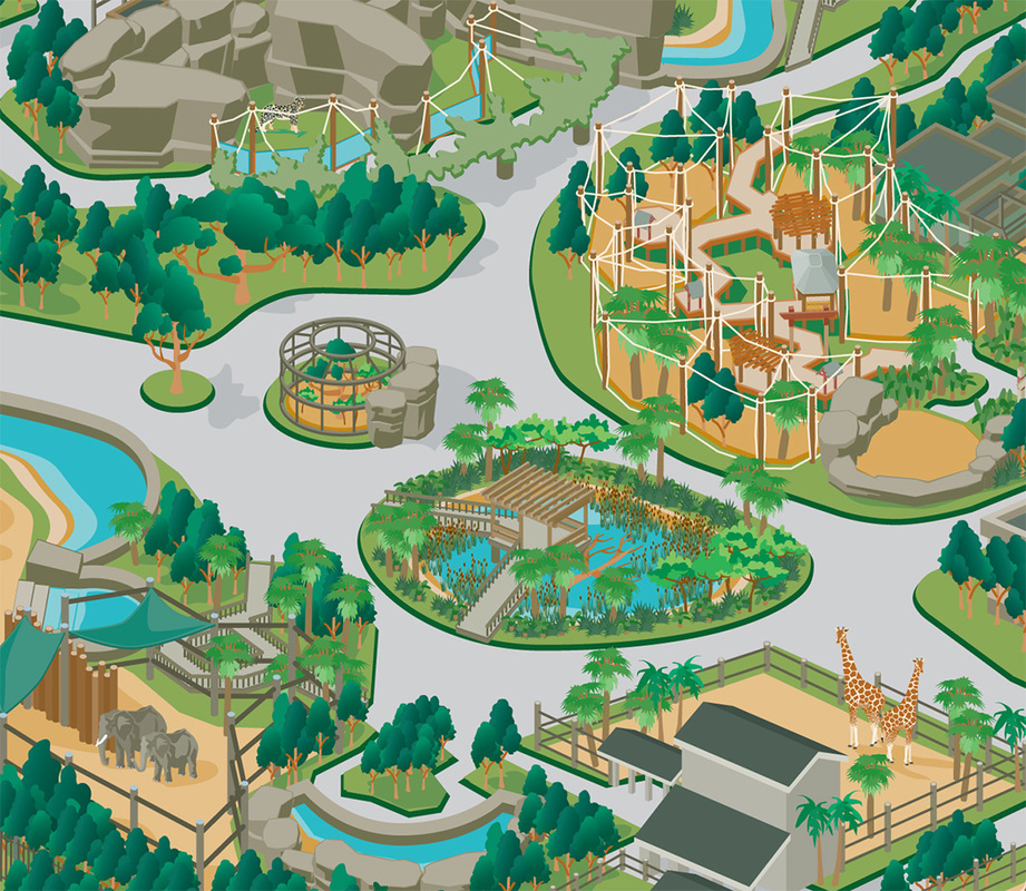
HOUSTON ZOO
|
Created in 2004, the Houston Zoo map included more than 55 acres of exhibits, 800 species of animals, play areas, education centers and meeting spots. Clear and accurate rendering of the hundreds of buildings and features allow the guest to visually identify their surroundings and location.
|
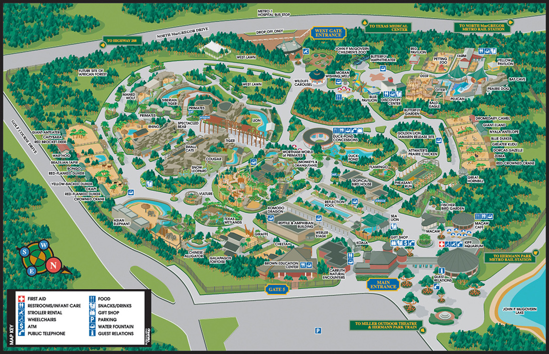
HOUSTON ZOO
|
RAGING WATERS
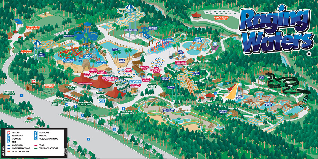
RAGING WATERS
|
Similar to zoos, water parks include a huge variety of elements. 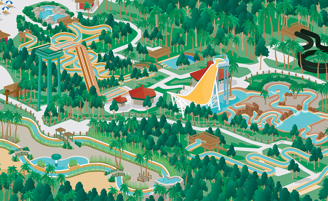
Raging Waters detail
|
ESSEX COUNTY NEW YORKEssex County in upstate New York covers almost 1,800 square miles. Home to the High Peaks of the Adirondacks, Lake Placid home of the 1932 and 1980 Winter Olympic Games and Adirondack Park.
Adirondack Park comprises over 6 million acres, 10,000 lakes, 30,000 rivers and streams and 102 towns situated amongst old growth forest, bordered on the East by Lake Champlain. |
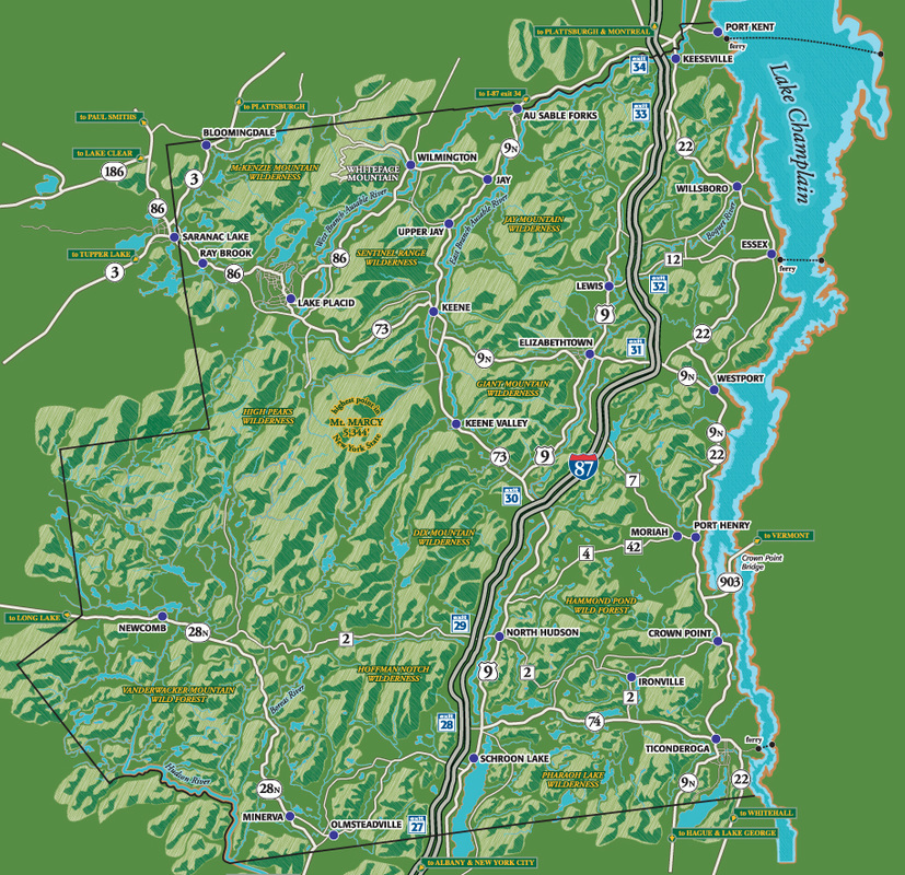
ESSEX COUNTY NEW YORK
|

|